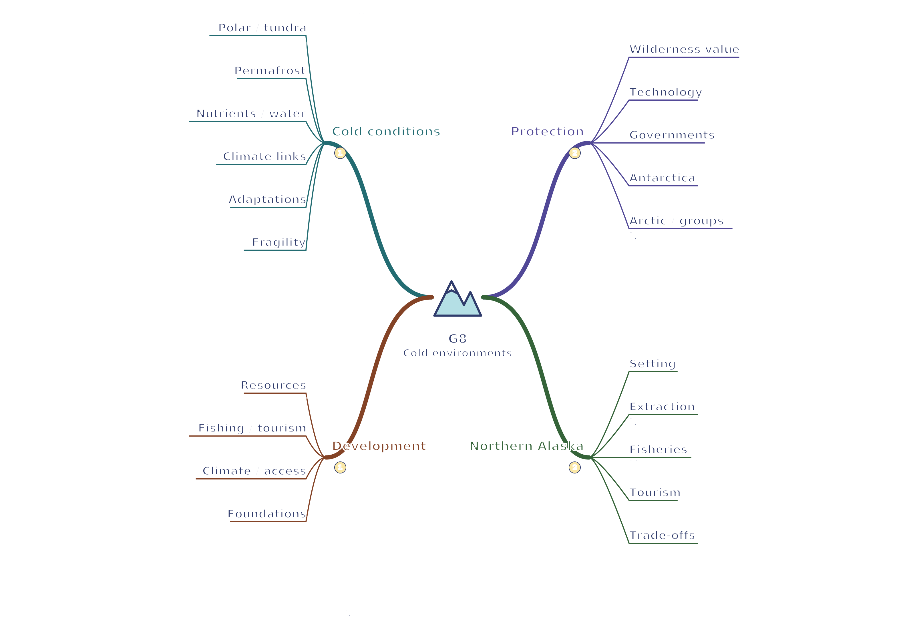
Back to revision notes Open full-size SVG Print mind map G8 Cold environments mind map Use your browser’s Print command for A4 landscape, or choose A3 in its paper settings. The SVG remains sharp when enlarged. A text version follows the map.
Read the mind map as text Cold conditions Polar / tundra: Polar ice/cold; beyond northern tree line tundra has short summersPermafrost: Ground ≤0°C for ≥2 years; active layer thaws seasonallyNutrients / water: Slow decay; shallow roots; meltwater can waterlog frozen groundClimate links: Thaw alters drainage, vegetation and foundationsAdaptations: Low plants/hairy leaves; fur, fat or migration vary by speciesFragility: Low biodiversity/simple webs; growth and recovery are slowDevelopment Resources: Oil/gas/minerals: jobs and revenue versus habitat and spill risksFishing / tourism: Income, but monitor catches, bycatch and visitor disturbanceClimate / access: Cold/dark winters and remoteness raise work/transport costsFoundations: Limit ground warming; permafrost thaw causes uneven subsidenceProtection Wilderness value: Habitats, science and cultural homes; not empty of people/historyTechnology: Raised/insulated infrastructure, leak checks and seasonal routesGovernments: Protected areas/assessments; enforce and consult residentsAntarctica: Treaty science/cooperation; mineral activity banned except researchArctic / groups: National laws and cooperation; research/campaigns; respect local rightsNorthern Alaska Setting: Cold northern areas; not all Alaska is tundraExtraction: North Slope oil → Valdez pipeline; Red Dog zinc; transport/waste costsFisheries: Marine pollock/salmon/crab need stock management; not tundra fishingTourism: Gates of the Arctic: wilderness appeal and difficult accessTrade-offs: Thaw, spills and costly services; involve Indigenous/local communitiesConnections Cold conditions → Development: Frozen ground constrains infrastructure Protection → Northern Alaska: Local livelihoods must inform conservation choices