Geographical location — Describe a place using both absolute location, such as latitude and longitude (numbered positions north/south and east/west on Earth), and relative location, such as its position beside a sea or south of a mountain range. These answer different questions. A city's coordinates locate a point, while its relationships to transport routes, water and neighbouring settlements help explain its development. Use an atlas or globe to check every unfamiliar place.
Continents, countries and regions — A continent is a large geographical division, a country is a political territory and a region is an area defined for a particular purpose. Their boundaries and meanings differ. Africa is not a country, Russia spans parts of Europe and Asia, and the Middle East is a region whose precise membership varies by definition. State which definition a map uses instead of treating every boundary as a natural fact.
Maps, globes and distortion — A globe represents the Earth's curved surface; a flat map must distort some combination of area, shape, direction or distance. A world map useful for navigation may exaggerate high-latitude areas. A projection is the method used to draw curved Earth on a flat map. Scale compares a map distance with the real distance. Check both before judging relative size. A simplified location map helps orientation but does not replace a detailed atlas for borders, relief or a route.
Latitude and environmental patterns — Latitude measures angular distance north or south of the Equator and influences received solar energy. Longitude measures angular distance east or west of the reference meridian: the 0° line through Greenwich. Altitude means height above sea level; ocean circulation means the movement of ocean water. Latitude helps explain broad temperature patterns, but altitude, ocean influence and circulation also matter. Two places at similar latitude can have different climates; location is a starting explanation rather than a complete one.
Physical and human characteristics — Physical characteristics include relief (the height and shape of land), climate, rivers and vegetation. Human characteristics include settlements, population, livelihoods (how people support themselves) and infrastructure (systems such as roads, power and water supplies). They interact: a river can supply water and transport while also bringing flood risk. Describe evidence at the appropriate scale and avoid explaining a whole country's people or economy from one physical feature.
Africa's varied geography
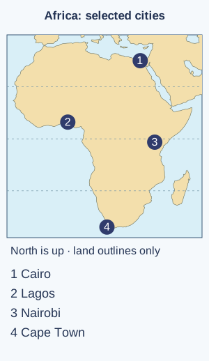
Locating Africa — Africa straddles the Equator and extends into both hemispheres. The Atlantic lies to its west and the Indian Ocean to its east; the Mediterranean borders its north. Use a world atlas to locate Egypt, Nigeria, Kenya and South Africa, then cities such as Cairo, Lagos, Nairobi and Cape Town. These examples show variation rather than a single representative 'African place'.Orientation map of African land with selected cities, using public-domain Natural Earth outlines and city coordinates. North is up; no political boundaries are shown. Low-resolution equirectangular mapping distorts area and is not for navigation. Full-size diagram
Environmental regions in Africa — The Sahara is a vast hot-desert region in northern Africa, while equatorial parts of the Congo Basin have tropical rainforest conditions and some eastern areas have highlands. Savanna is mainly grassland with scattered trees. Many savanna areas have a wetter season and a drier season, which affect plant growth and available water. These regions cross country borders and contain variation. A photograph of one dry landscape cannot establish that the whole continent is desert.
The Nile and settlement — The Nile flows north through north-eastern Africa towards the Mediterranean, supporting irrigated farming, where people supply water to crops, and settlements in otherwise dry areas. A delta is low-lying land built where a river deposits material near its mouth. Sediment is material such as sand and mud carried by water. Cairo lies near the head of the delta, and Alexandria is on the Mediterranean coast. Water supply, fertile land and transport help explain settlement, while dams, irrigation and cities also alter water and sediment movement. River benefits and risks are linked.
Africa's cities and connections — Cities such as Lagos, Nairobi and Cairo have different histories, industries, transport networks and environmental challenges. Ports connect some places to overseas trade, while other cities serve inland or regional functions. Avoid describing every city only through poverty or rapid growth. Compare particular neighbourhoods, services and economic links with dated evidence rather than generalising from one image.
Russia and high latitudes
Locating Russia — Russia extends across northern Europe and Asia, from areas near the Baltic region towards the Pacific. Moscow and St Petersburg lie in its western part, while Vladivostok lies on the Pacific side. Use a globe to appreciate its east–west extent and Arctic coastline. Do not infer population distribution simply from the size of territory shown on a distorted flat map.Orientation map of northern Eurasian land showing Moscow in the west. No political borders are shown; use an atlas to identify Russia, its Pacific cities and neighbouring countries. Natural Earth land and point data; equirectangular projection is not equal-area. Full-size diagram
Russia's environmental regions — Northern areas include tundra, where low-growing plants grow above ground that is often frozen below the surface. Much of Siberia includes extensive coniferous forest, mainly cone-bearing trees, known as taiga, and more southerly areas include grasslands and other environments. Climate, vegetation and frozen ground vary across this immense area. Not all Russia is permanently frozen or environmentally identical. Latitude, continental distance and relief help explain contrasts.
People and resources in Russia — Population and major urban concentrations are unevenly distributed, with many people in the western part and along established corridors. Resources, transport routes and industrial development connect physical and human geography. Extracting and moving resources in cold or remote environments can be difficult and can affect ecosystems. Use current evidence for economic or political claims rather than treating a map as timeless proof.
Polar environments — Polar environments receive low-angle sunlight and have strong seasonal contrasts in daylight. Cold conditions can limit plant growth and influence transport, settlement and infrastructure. Antarctica is a continent dominated by land ice, while the Arctic includes an ocean surrounded by land. Sea ice is frozen seawater. A glacier is a mass of land ice that moves slowly. Permafrost is ground that stays frozen for at least two years. These features respond differently to change.
Asia, China and India
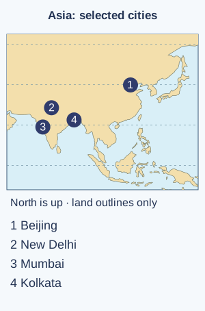
Locating Asia — Asia includes very varied environments and many countries, from western regions towards the Pacific and from Arctic latitudes to equatorial areas. Locate China, India, Japan, Indonesia and Saudi Arabia using an atlas, noting that Asia is not one climate or culture. Mountain ranges, oceans and transport links help explain contrasts and connections within the continent.Orientation map of Asian land with selected cities in China and India from Natural Earth. The city markers do not define national boundaries; use an atlas for country and relief detail. North is up and the projection is not equal-area. Full-size diagram
China's physical contrasts — China has high plateaus and mountains in its west and extensive lower-lying, more densely settled areas towards the east. The Himalayas lie along part of the south-western margin and major river systems include the Yangtze and Huang He. Dry inland regions contrast with wetter monsoon-influenced areas. A national average hides substantial regional differences in water, relief and settlement.
China's cities and links — Beijing is the capital in northern China, while Shanghai is a major coastal city near the Yangtze's mouth. Transport, manufacturing, services and international trade link cities with rural and overseas places. Compare specific locations and dated evidence rather than presenting every Chinese region as one industrial landscape or assuming all people share the same livelihood.
India's physical contrasts — India lies in South Asia, with the Himalayas to the north, a major northern river plain and the Deccan Plateau farther south. The Arabian Sea lies to the west and the Bay of Bengal to the east. Seasonal monsoon circulation strongly influences rainfall, but totals and timing vary. A mountain foothill, a dry western area and a coastal delta have different environmental opportunities and risks.
India's cities and connections — New Delhi is India's capital, Mumbai lies on the western coast and Kolkata is in the east near the lower Ganges region. Their functions and links differ, including administration, services, industry and ports. Urban growth interacts with housing, transport, water and employment. Avoid reducing the country to one city or treating all residents as having the same living conditions.
The Middle East and environmental comparison
Locating the Middle East — The Middle East links parts of south-western Asia and, in many definitions, north-eastern Africa. Use an atlas to locate Egypt, Saudi Arabia, Iraq, Iran and Türkiye, and cities such as Cairo, Riyadh, Baghdad, Tehran and Istanbul. Regional membership and some boundaries are contested, so use a stated map convention and distinguish geographic description from political claims.Orientation map linking north-eastern Africa and south-western Asia through selected cities. Natural Earth land and point inputs; no borders or disputed political claims are implied. Regional membership varies and needs a stated convention. Full-size diagram
Water and dry environments — Much of the region has dry conditions, but mountains, coasts and river valleys create important variation. The Tigris and Euphrates cross several territories, while parts of the Arabian Peninsula are hot desert. Water supply can involve rivers, groundwater (water stored below the surface), reservoirs (stored water, often behind a dam) and desalination (removing salt from seawater). Access also depends on infrastructure, management and demand, not climate alone.
Resources, cities and diversity — Oil and gas are important in some places, but the region also includes farming, manufacturing, tourism and diverse service economies. Not every country has the same resource wealth or opportunities. Cities and rural places are linked by labour, food, water, energy and trade. Use specific evidence and avoid presenting a regional label as a single religion, language or way of life.
Hot and polar deserts — Precipitation is water falling from the atmosphere, including rain and snow. A desert is defined by very low precipitation, not necessarily high temperature or sand dunes. Hot deserts such as parts of the Sahara differ from polar deserts in temperature, daylight and vegetation, while both can have limited moisture. Explain adaptations and human use in a specific place rather than assuming all dry environments are empty or lifeless.
Connections across scales — A local food purchase can link farms, water use, transport, processing and trade in several places. Follow one traceable example and identify both benefits and possible pressures. Countries are internally varied and internationally connected, so a simple 'rich country versus poor country' picture cannot explain every person's experience or every environmental effect.
Test yourself
50 questions · Random sets of 10. These quick checks support revision; practise longer explanations and justified judgements too.
Mind map
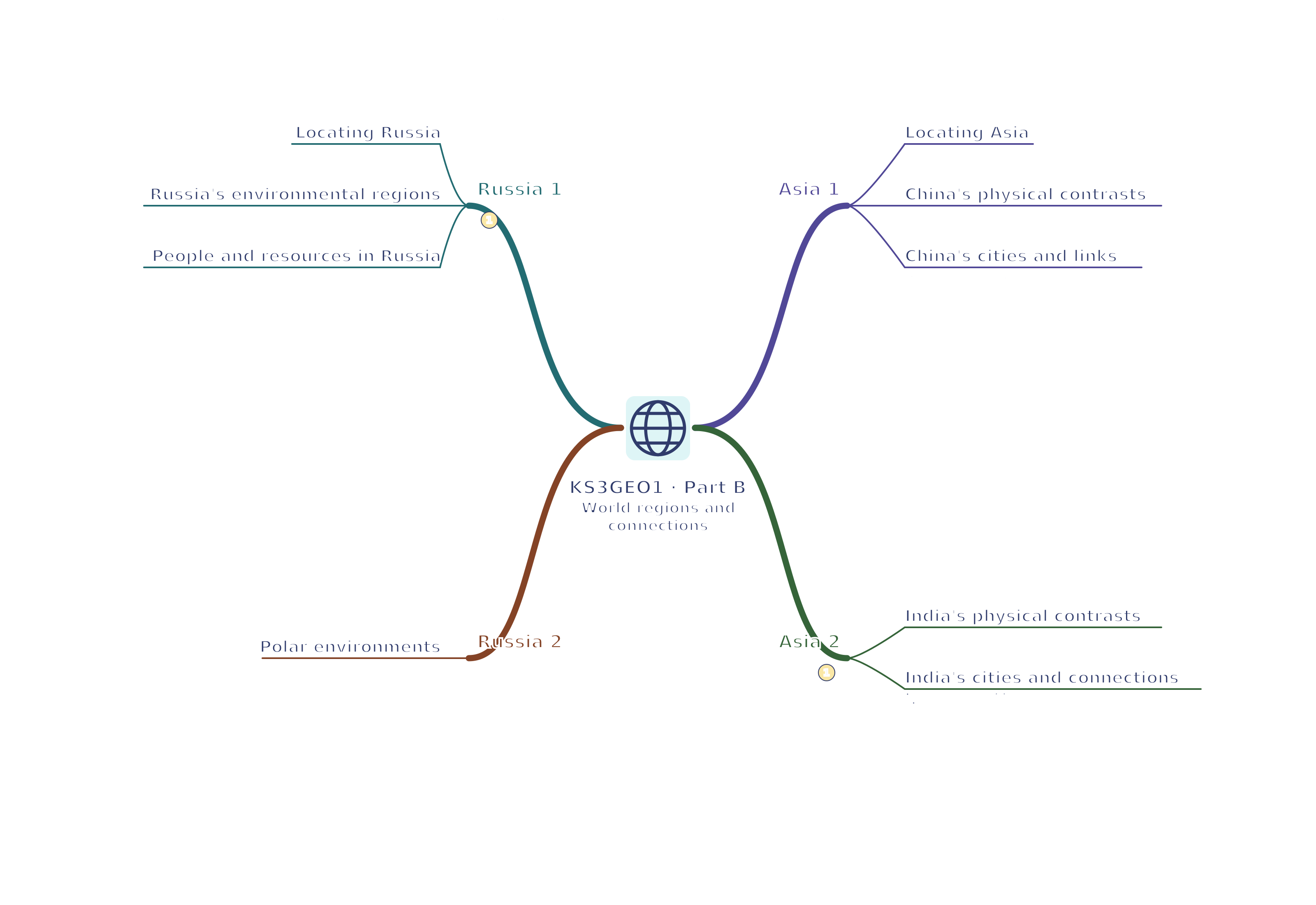
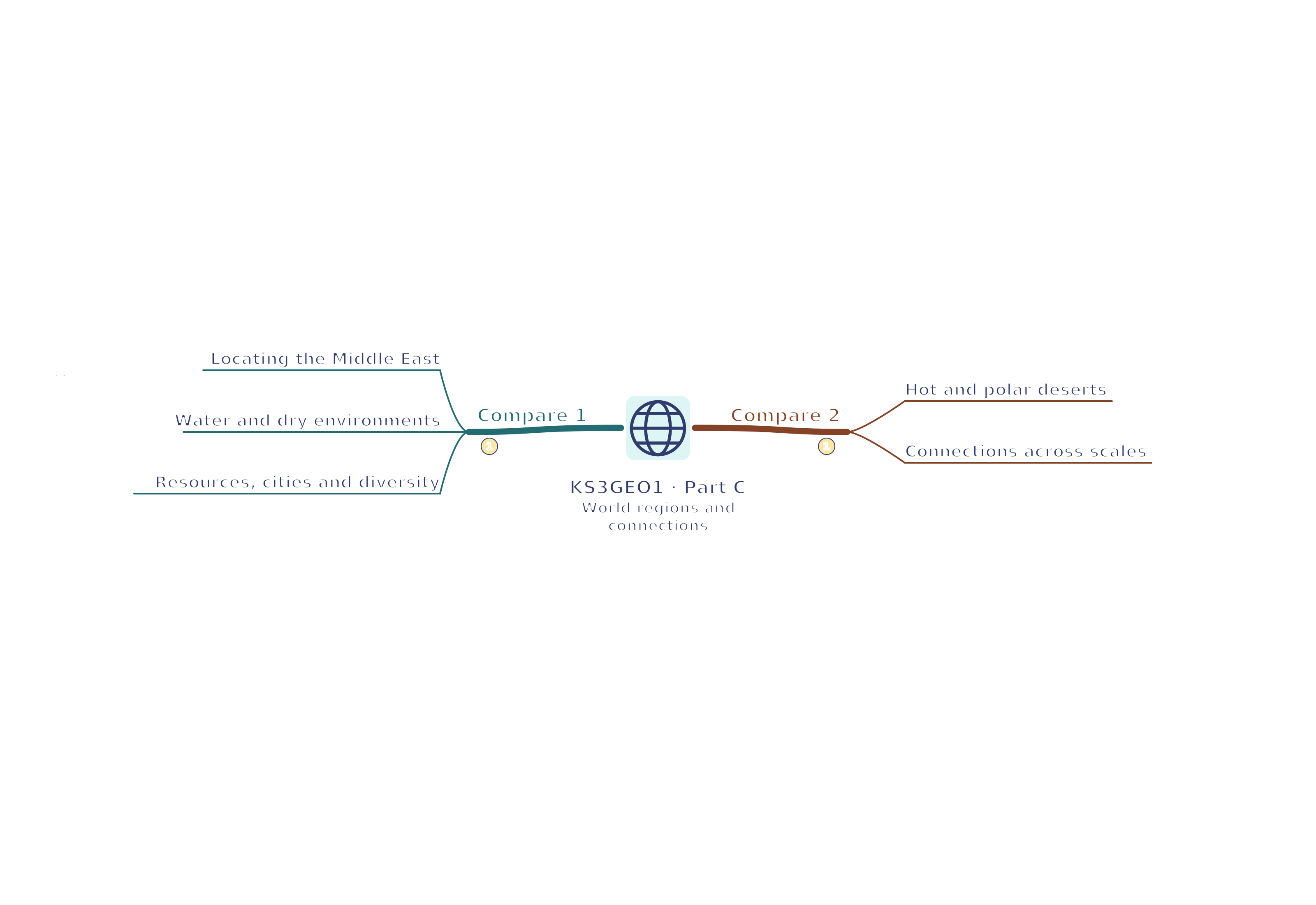
Use the branches to recall the ideas and explain their connections. Check the revision notes for the full detail.
KS3GEO1 · 1
View KS3GEO1 · 1 mind mapOpen the full-size map to zoom. Use the printable view for A4 landscape or enlarge to A3.
 Mr Kidman's Classroom